

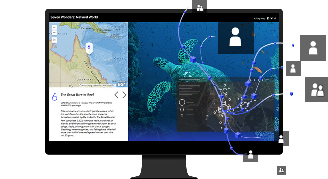
Create interactive maps that explain your data and encourage users to explore.
Map your own data and gain perspective adding valid location-based data included in ArcGIS Online. Use smart mapping to guide exploration and visualize your data.
Share your maps with specific groups or with everyone.
Create web applications with your maps for one focused, interactive experience. Then incorporate the applications you created in your digital presence, including your website, posts on social media and blog articles.
Work effectively on your entire organization to create and use maps.
Users get secure, easy access to their data maps and applications needed to get their job done. ArcGIS Online is ready for business, that meets the needs of security, authentication, privacy and user management of large organizations.
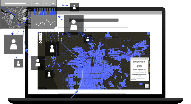
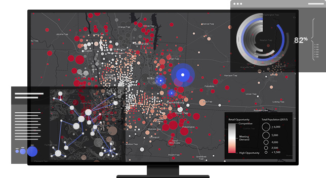
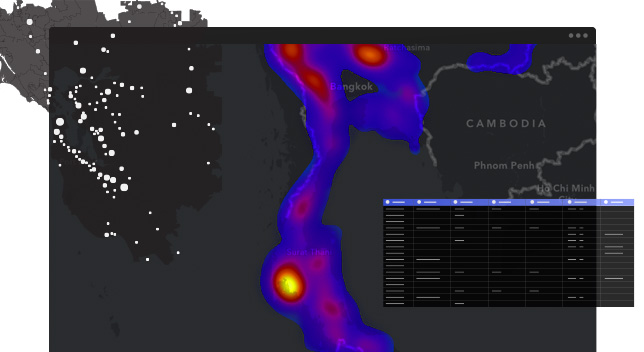
Understand your data within the site using intuitive analysis tools.
Discover relationships, identify top locations, use optimal routes and analyze patterns to make predictions. Add valuable context to your data combining them with demographic data and its data Esri lifestyle.
Bring your data to a powerful activating system geoinformation, servers and scales.
Update and add to your data without disturbing maps and applications that use the data. Check who is adding and modifying your data.
Since it is software as a service (SaaS), ArcGIS Online runs on any device with a connection to Internet. Its world-class infrastructure allows your maps to be scaled up so thousands of people can at the same time interact with them. Esri manages software updates and maintenance for you
Trusted by even the most controlled industries, the ArcGIS Online is constantly gaining security certifications and privacy. It is durable, redundant and built from scratch with based on safety.
ArcGIS Online meets your requirements in its field IT, including security, control identity and confidentiality. Provides recording and more advanced reports so you can keep track of them activities of your organization. You can also integrate the link for your organization.
Use scientific analytical tools in 2D, 3D and 4D data to identify patterns, make predictions and answer questions. Quickly share projects and information within your organization, online and through mobile apps.
Combine data from different sources and formats. ArcGIS Pro supports industry and community standards to ensure the inclusion of any data set you have.
Display data in 2D and 3D at the same time. Manage multiple maps and layouts in a single workflow based project.
Simplify data processing and analysis with tools environmentally sensitive. Perform 2D and interactive analysis 3D. Automatic work with ModelBuilder or Python.
Publish maps and analysis results as web services or high quality prints. Share maps and data in ArcGIS Online, ArcGIS Enterprise or as a package.